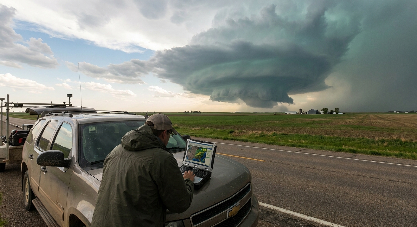
Standing under a mature supercell is like walking into the exposed heart of the atmosphere. Nothing in textbooks quite prepares you for the low, surging inflow, the stacked plates of the updraft, or the feeling that the sky has started rotating around your existence.
Meeting the Machine Up Close
To chase supercells with intention—not just luck—you need to understand their internal anatomy. Once you recognize each part of the storm, radar and visual cues snap together into a coherent living system instead of random chaos.
Let’s dissect the rotating engine from the inside out.
The Fuel: Instability, Shear, and the Cap
Every supercell is built on three critical ingredients. You’ll see these terms in every forecast, but on chase day, they translate directly into storm behavior.
1. Instability (CAPE)
Convective Available Potential Energy is what lets parcels of warm, moist air rocket upward. Higher CAPE = stronger potential updrafts.
On the Plains, classic supercell days often show:
- MLCAPE: 1500–3500 J/kg
- Steep mid‑level lapse rates from elevated mixed layers advecting over rich Gulf moisture
More CAPE doesn’t always mean more tornadoes, but it does mean taller, more explosive towers and more intense precipitation loading.
2. Vertical Wind Shear
Supercells need winds that change speed and direction with height, so their updrafts can tilt and rotate instead of collapsing.
Look for:
- 0–6 km bulk shear > 35–40 kt for sustained supercells
- 0–1 km shear and SRH > 100–200 m²/s² for enhanced tornado potential
Strong shear allows the storm to separate its updraft from its downdraft, keeping the engine running for hours.
3. The Cap (CINH)
The cap is a warm layer aloft that suppresses convection. It’s both enemy and ally:
- Too strong and nothing breaks through—blue sky bust.
- Just strong enough and it holds storms back until peak heating, allowing a few explosive, isolated supercells.
When the cap erodes along a boundary, the first storm to break often becomes the dominant, rotating monster of the day.
The Core Components of a Classic Supercell
Think of a supercell as a rotating engine with specific working parts. As a chaser, you’re trying to stay near the safest windows into that engine.
1. The Updraft Tower
This is the vertical axis of the storm:
- Visually: towering, crisp, cauliflower cloud rising into the anvil
- On radar: the core of high reflectivity where rain and hail form
Within the updraft, strong vertical velocities (often 40–60+ m/s) pull in warm, moist air and loft hydrometeors to enormous heights.
2. The Mesocyclone
This is the rotating core of the storm:
- Visually: the large, rotating region beneath the main updraft
- On radar: a persistent velocity couplet of inbound/outbound winds
The mesocyclone is where tornadoes are born, where structure becomes sculpted and striated, and where the storm’s personality reveals itself.
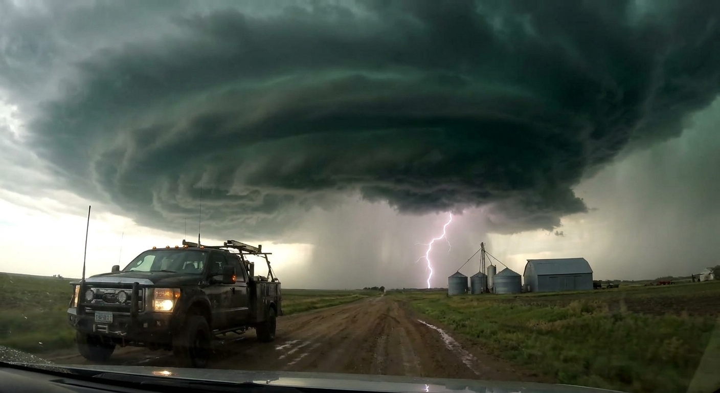
3. The Forward-Flank Downdraft (FFD)
North and east of the updraft, heavy rain and hail crash to the ground:
- Visually: the murky, rain-filled part of the storm
- On radar: large region of high reflectivity north/east of the meso
The FFD can obscure tornadoes on the other side of the storm. Get too deep into it and you lose visibility and traction.
4. The Rear-Flank Downdraft (RFD)
The RFD is one of the most critical—and misunderstood—parts of supercell anatomy.
- Visually: a clear slot or bright region wrapping around the meso
- Often accompanied by a surge of cooler, sometimes dust‑laden air
- On radar: a "notch" or lower reflectivity wrapping into the hook
RFD plays a major role in tornado formation by tightening rotation and helping focus low‑level vorticity. But it’s also treacherous; an RFD surge can wrap rain and hail around a tornado, making it rain‑wrapped and nearly invisible.
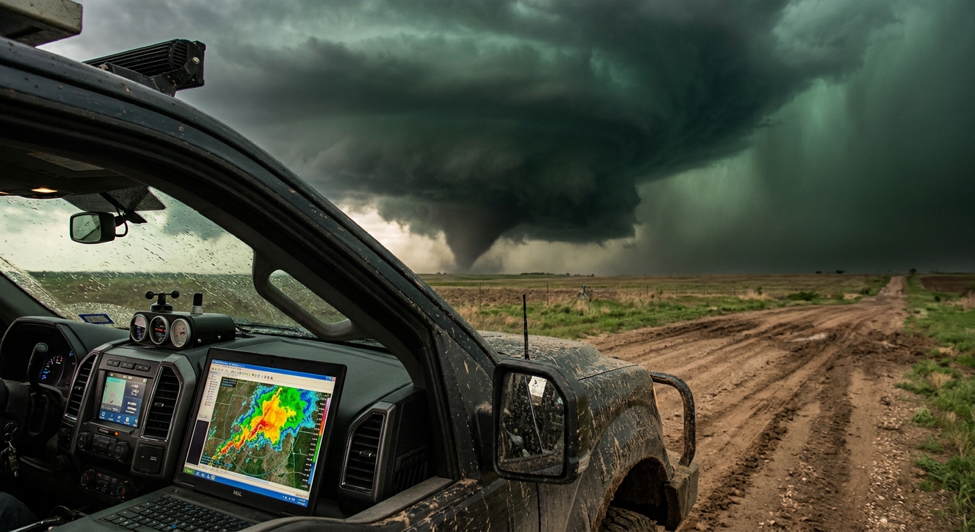
Wall Clouds, Tail Clouds, and the Birthplace of Tornadoes
When you’re under the inflow region looking up at the base, you’ll often see distinct lowerings and inflow features.
Wall Cloud
- A localized, persistent lowering beneath the main updraft base
- Forms where warm, moist inflow rises and saturates rapidly
- Often the primary focus for tornado genesis
Signs of a tornadic wall cloud:
- Rapid, smooth rotation
- Strong, organized inflow feeding into it
- Rising scud getting ingested into the circulation
Tail Cloud
- A horizontal, band‑like cloud feeding into the wall cloud from the FFD/precip region
- Indicates focused inflow into the mesocyclone
When the wall cloud tightens, rotation increases, and a funnel begins to condense, you’re watching the engine’s angular momentum being squeezed—like an ice skater pulling in their arms.
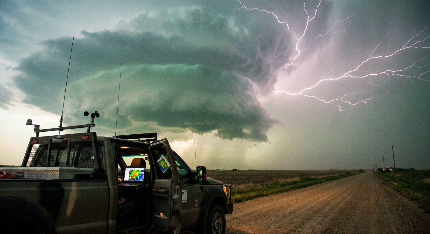
Radar Anatomy: Seeing Inside the Beast
On radar, a classic supercell often takes a shape that’s instantly recognizable once you’ve watched enough loops.
Reflectivity Signatures
- Hook Echo: Curved appendage on the southwestern flank—wraparound precip around the meso.
- Bounded Weak Echo Region (BWER): Weak reflectivity surrounded by higher returns—strong updraft lofting precip above the radar beam.
- Echo Overhang: Overhanging high reflectivity above weaker low‑level returns.
On higher tilts, these features reveal just how violently the storm is circulating precipitation aloft.
Velocity Signatures
Velocity products show motion toward/away from the radar.
Key features:
- Mesocyclone couplet: Broader region of rotation aloft
- Tornado vortex signature (TVS): Tight, intense couplet near the surface
- Rear-inflow jets: Strong surges behind bowing segments in linear systems
Chasing with velocity data isn’t optional; it’s the difference between positioning intentionally versus wandering near rotation by accident.
Supercell Morphologies: How Structure Changes the Chase
Not all supercells behave the same. Their shape affects your tactics.
Classic Supercell
- Distinct hook, clear inflow region, separated FFD core
- Best for chasing visually and for discrete tornadoes
- Often found near drylines with moderate moisture and shear
HP (High-Precipitation) Supercell
- Wrapped in rain, messy, smaller rain‑free base
- Tornadoes are often embedded and rain‑wrapped
- Dangerous for close chasing; radar and road knowledge become critical
LP (Low-Precipitation) Supercell
- Sculpted, photogenic, relatively low radar returns
- Narrow updraft, sometimes large hail despite minimal rain
- Tornadoes are less common but possible
As moisture and storm interactions change, a classic supercell can evolve toward HP, especially after dark. When it does, chaser risk multiplies.
Behavioral Patterns: Lifecycles and Storm Motions
Most supercells follow a loose lifecycle:
- Initiation – Cumulus towers explode, a dominant cell emerges.
- Organization – Rotation develops, structure sharpens, anvils spread.
- Maturity – Strong mesocyclone, organized RFD/FFD, peak tornado risk.
- Occlusion – Tornado cycles, older meso occludes, new one may form.
- Decay or Transition – Storm weakens or merges into a line/cluster.
Tornadoes often occur during occlusion cycles, when new low‑level mesocyclones spin up closer to the inflow region, sometimes displaced from the original core.
Storm motion often deviates from mean wind due to internal dynamics. Supercells tend to move to the right of mean wind vectors (right‑movers). This right turn is not just academic; it can shift the tornado path unexpectedly.
Why This Anatomy Lesson Matters in the Field
When you’re out there, with sirens in the distance and inflow tugging at your clothes, this isn’t just theory.
- Knowing where the FFD and RFD are helps you avoid driving blind into the worst part of the storm.
- Recognizing an organizing wall cloud vs. harmless scud keeps you watching the right part of the base.
- Understanding HP vs. classic structure tells you when to increase distance, not decrease it.
Supercells are violent engines, but they are not random. They are exquisitely structured responses to imbalance in the atmosphere.
Learn their anatomy, and you don’t just chase them—you anticipate their next move. That’s how we keep coming back, awed but alive, as the rotating machines of the Plains rewrite the sky again and again.