Most people only start paying attention when a named hurricane threatens land. By then, the atmosphere has been whispering warnings for a week.
Why the First Cloud Cluster Matters
Storm chasers and hardcore weather watchers know: the story begins as a smudge of convection rolling off Africa, or a disorganized mess in the Caribbean that shouldn’t get its act together—but sometimes does.
Tracking that evolution from harmless tropical wave to organized hurricane is where the real obsession lives.
This is the step‑by‑step guide to following that entire life cycle, from the first pixel cluster to a fully formed beast.
Step 1: Spotting the Seed – Easterly Waves and Disturbances
Every major hurricane starts life as a disturbance—usually one of these:
- African Easterly Waves (AEWs) rolling off the Sahel during hurricane season.
- Monsoon trough disturbances in the Caribbean or Gulf.
- Old frontal boundaries decaying over warm water.
What to Watch on Satellite
Use visible and infrared satellite loops to look for:
- A coherent wave signature: a kink in the cloud field or a clear, westward-moving bulge.
- Persistent deep convection: thunderstorms that keep firing over the same area for 24–48 hours.
- Low-level spin: subtle rotation in the low clouds on high-res visible imagery.
When I see a wave that holds its convection all through the night and reorganizes the next morning, I flag it. Many don’t survive—but all major hurricanes are built on this kind of stubbornness.
Step 2: Environment Check – Is the Atmosphere Open for Business?
A promising disturbance is nothing without a hospitable environment. Veteran trackers instinctively scan three main parameters:
1. Sea Surface Temperatures (SSTs)
- 26.5°C (80°F) or higher is the usual minimum.
- Deeper warm layers (high ocean heat content) favor rapid intensification.
2. Wind Shear
- Low vertical wind shear (generally < 20 kt) is key.
- High shear tilts and disrupts the storm, blowing convection away from its center.
3. Moisture
- A moist mid-level environment supports persistent thunderstorms.
- Dry air (like Saharan dust) can choke off development or cause lopsided convection.
I run through these like a pre-flight checklist. If SSTs are hot, shear is low, and mid-level humidity is high, that little cloud cluster suddenly looks a lot more ominous.
Step 3: Watching for Organization – From Invest to Depression
When the National Hurricane Center tags a disturbance as an Invest (e.g., 90L), we’re in business. That means:
- It’s now being tracked with dedicated model runs.
- We’ll start seeing ensembles, intensity guidance, and better analysis.
The First Signs of a Real Cyclone
On satellite and scatterometer data, look for:
- Closed circulation at the surface (winds wrapping 360° around a center).
- Convection consolidating over or near that center.
- Curved band features instead of random blobs.
Once multiple data sources confirm a closed, coherent rotation plus sustained convection, we’re usually on the verge of a tropical depression designation.
Step 4: Tropical Storm Status – The First Name
A system becomes a tropical storm when sustained winds reach 39 mph (34 kt). That’s often when the public finally looks up—meanwhile, trackers have been watching it brew for days.
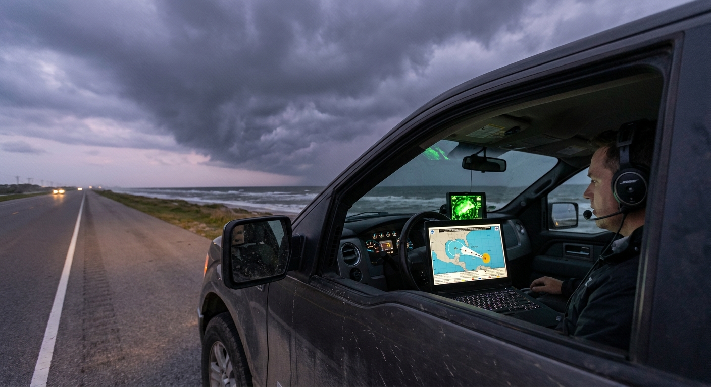
Tracking Tools Intensify
Now we lean on:
- Official NHC advisories & forecasts – Track, intensity, hazards.
- Spaghetti plots – Ensemble clusters showing spread of possible tracks.
- Intensity models – SHIPS, HAFS, etc., hinting at which way the wind is blowing—literally and figuratively.
Structure on Satellite and Radar
- Expect to see more defined banding, especially on the poleward side.
- If near land or radars, weak banding appears as curved arcs of light to moderate reflectivity.
At this stage, the storm is still malleable. Small changes in shear, dry air, or timing can make or break its run to hurricane status.
Step 5: Rapid Intensification — When the Engine Catches
Some storms grind upward, barely making hurricane strength. Others suddenly punch the gas.
Rapid intensification (RI) is typically defined as a 35 kt (40 mph) or more increase in max sustained winds within 24 hours.
The RI Red Flags
Storm chasers perk up when we see:
- Very warm SSTs + deep ocean heat content.
- Low shear and excellent outflow aloft (often seen as impressive upper-level cirrus outflow on satellite).
- Compact inner core with a tightening radius of maximum winds.
- Persistent, symmetric central dense overcast (CDO).
On infrared imagery, the cloud tops around the center get extremely cold; convection towers explode; a tiny, pinhole eye might appear. The models will often lag reality in these moments.
On one chase, we watched a Category 1 in the Gulf that “should” have crept upward… instead it ramped into a major hurricane overnight. The signals were all there—boiling SSTs, perfect outflow, a consolidating core—but the official forecast had to play catch up. That’s the kind of night that keeps us glued to each new frame.
Step 6: Mature Hurricane – The Symmetric Beast
A fully developed hurricane on satellite is terrifyingly beautiful:
- Clear, round eye with warm brightness temperatures.
- Symmetric eyewall of cold cloud tops.
- Spiral rainbands fanning out hundreds of miles.
Tracking at This Stage
We now juggle:
- Track guidance: Where is the steering flow sending this thing? Ridges, troughs, and weakness in the subtropical high decide everything.
- Intensity changes: Eyewall replacement cycles, shear intrusions, land interaction.
Eyewall Replacement Cycles (ERCs)
Mature hurricanes often undergo ERCs:
- A secondary eyewall forms outside the original.
- The outer eyewall strengthens while the inner weakens and dissipates.
- Peak winds may briefly dip while the wind field expands.
For chasers, ERCs shift the danger zone outward. For coastal communities, they can mean widespread destructive winds instead of a narrow violent core.
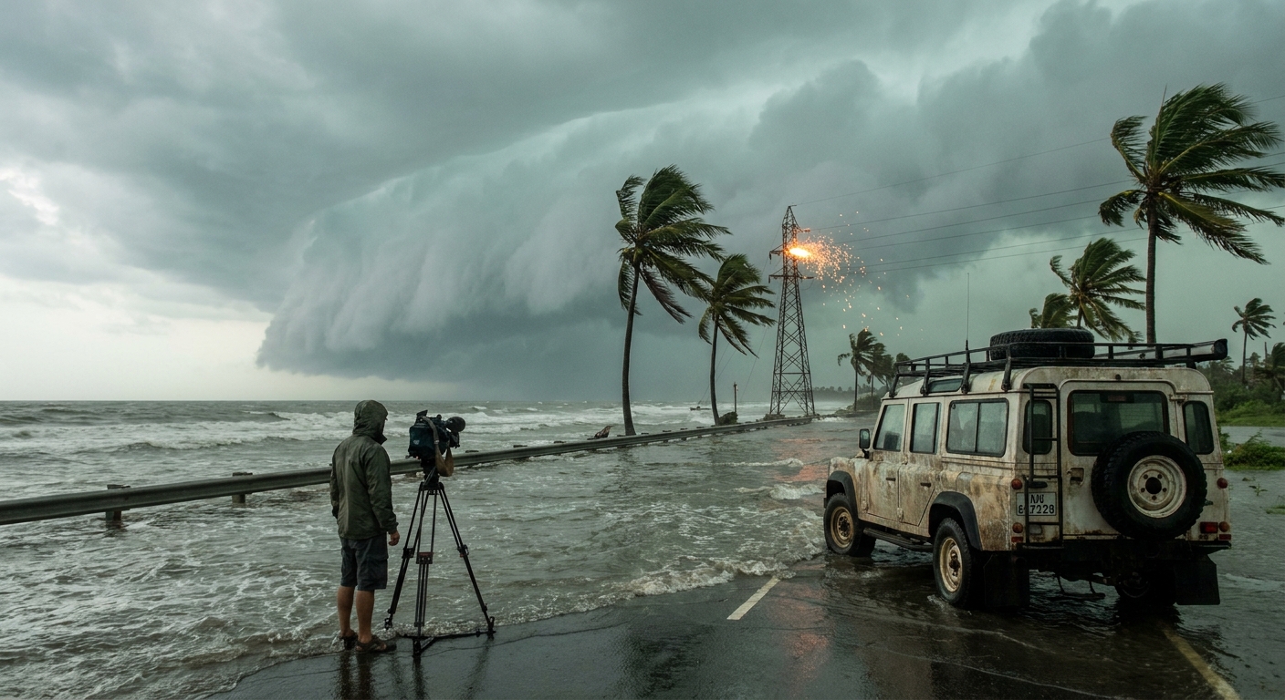
Step 7: Landfall and Decay – Impacts Don’t End at the Beach
When the inner core finally crosses land, friction and loss of oceanic fuel begin to weaken it. But tracking doesn’t stop there—far from it.
Two Critical Post-Landfall Threats
Inland Flooding
- Slow-moving remnants can unload staggering rainfall totals. - Topography funnels and amplifies runoff. - Rivers can crest days after the center has moved on.
Tornadoes
- Embedded in the outer bands, especially in the right-front quadrant. - Often weak-to-moderate but fast-forming and rain-wrapped.
On radar, those ragged bands look less impressive than the core, but I’ve seen more damage from inland flooding and tornadoes than from wind alone.
Step 8: Extratropical Transition – The Shape-Shifter
As the cyclone moves into cooler waters and higher latitudes, it can merge with troughs and fronts, morphing into an extratropical system.
What Changes
- The storm loses a warm-core structure and begins to tilt with height.
- Convection becomes asymmetric, with most weather on one side.
- The wind field often expands dramatically, even as max sustained winds decline.
Europe and higher-latitude coasts can take a serious beating from these former hurricanes, long after their names leave the headlines.
Safety Protocols Through the Life Cycle
As you track, align your safety posture with the storm’s phase.
Early Disturbance / Invest
- Start reviewing your hurricane plan and supplies.
- Note the 5–7 day risk window if you’re in the general basin.
Tropical Storm / Early Hurricane
- If you’re in a surge-prone area, identify your evacuation triggers well before watches go up.
- Follow official NHC and local EM updates every advisory cycle (typically every 6 hours).
Major Hurricane Approaching
- Evacuate early if told to—roads clog, and conditions degrade fast.
- Don’t rely on last-minute track shifts; we’ve watched wobbles erase “safe” zones overnight.
Inland / Post-Landfall
- Track rainfall totals and river forecasts, not just the center point.
- Respect tornado watches linked to tropical remnants; these can spin up quickly.
Becoming a Lifecycle Tracker
When you start following storms from their first breath as a nameless wave, you see the season differently:
- A dusty plume off Africa becomes a harbinger.
- A kink in the isobars over the Caribbean becomes a puzzle.
- A slight dip in wind shear on the charts feels like a loaded gun.
You don’t just meet hurricanes at landfall—you watch them grow, struggle, and sometimes explode into monsters.
That perspective doesn’t just feed the obsession; it buys time. Time to prepare, time to move, time to warn others who still think hurricanes appear out of nowhere overnight.
Track the whole life cycle, and you stop being surprised by the storm. You start anticipating it.