Stand on a beach as a hurricane roars in, and you’ll feel it immediately: some stretches of coast are being shredded, while others just miles away take a glancing blow.
Not All Sides of a Hurricane Are Equal
The storm is the same—but the impact zone is not.
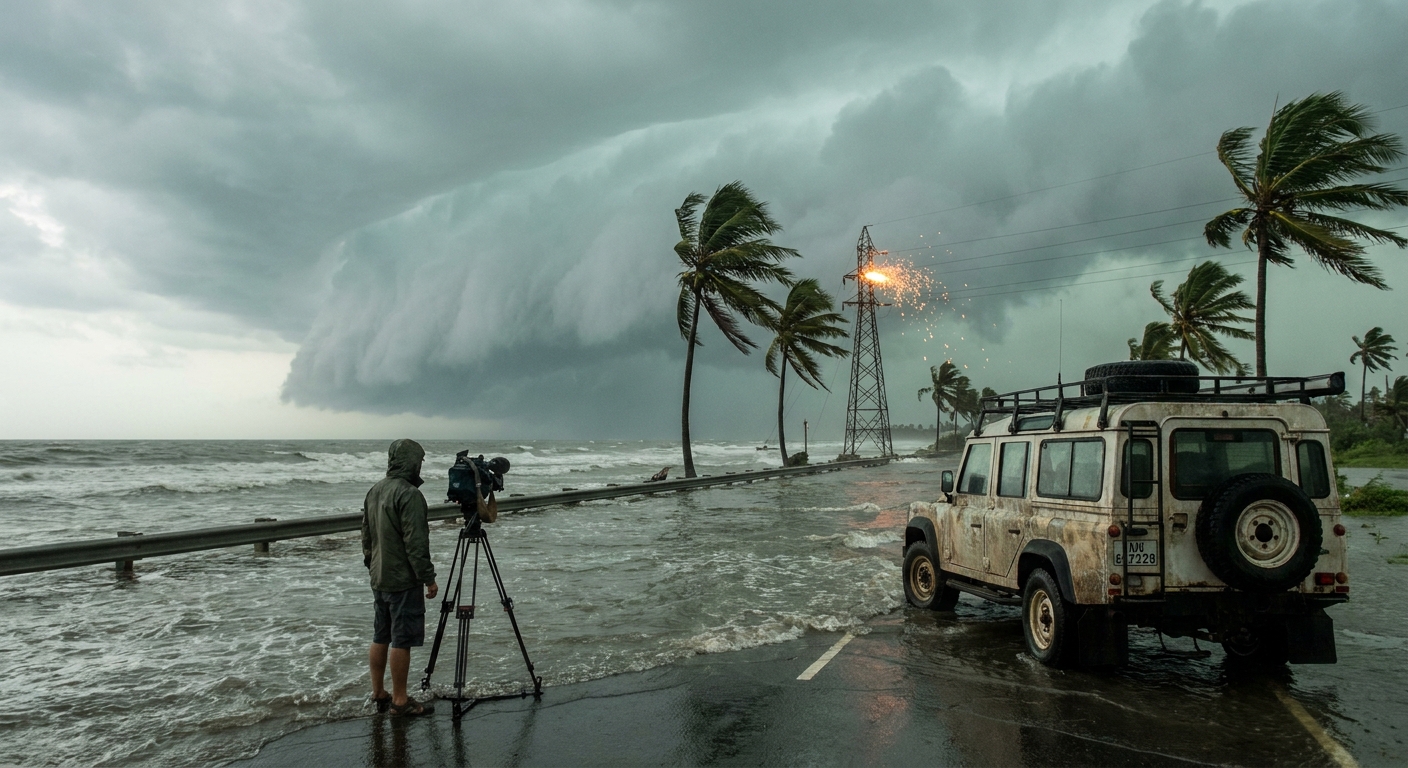
Storm chasers obsess over which side of the hurricane they’re on. Right side, left side, front, rear—each quadrant is its own world of hazards, driven by core meteorological mechanics. If you know how to read those zones, you know where to chase—and where to get out.
This is the quadrant guide I wish every coastal resident, emergency manager, and aspiring chaser carried in their glove box.
The Physics Behind the Fierce Right Front Quadrant
In the Northern Hemisphere, the right-front quadrant (relative to the storm’s motion) is usually the scariest place to be.
Why It Hits Hardest
Forward Motion + Rotational Wind
- The storm’s own circulation spins counterclockwise. - On the right side of its direction of travel, the rotational wind adds to the forward speed. - Result: higher absolute wind speeds at the surface.
Storm Surge Amplification
- On the right side, onshore winds push water toward the coast. - The central pressure deficit and wind stress pile water up into a dome. - Bays, inlets, and concave coastlines funnel this surge into catastrophic heights.
Tornado Hotspot
- Low-level shear and frictional effects favor tornado formation in the right-front sector.
During a landfalling major hurricane, we often set up just inside or near the edge of this quadrant if the goal is extreme wind footage—while planning an escape route like our lives depend on it, because they do.
Comparing Quadrants: A Chaser’s Field Notes
Let’s break down each quadrant the way we do on a chase map.
Right-Front Quadrant (RFQ)
- Dominant Hazards: Maximum sustained winds, peak gusts, worst storm surge, high tornado risk, violent wave action.
- Typical Experience: Roaring, continuous wind with spiraling rainbands. Water rises shockingly fast along coastlines.
- Chaser Strategy: Only attempt close intercepts with impeccable escape routes and high-clearance vehicles; never in surge-prone or barrier island locations.
Left-Front Quadrant (LFQ)
- Dominant Hazards: Strong winds but usually lower than RFQ, still dangerous surge in some geometries, heavy rainfall.
- Typical Experience: Intense but somewhat less chaotic; more manageable for inland chases.
- Chaser Strategy: Preferred for those wanting serious conditions without the absolute worst surge and tornado combo.
Right-Rear Quadrant (RRQ)
- Dominant Hazards: Training rainbands, inland flooding, continued tornado potential, prolonged winds.
- Typical Experience: Feels like a second act—storm “past” but impacts ramp back up, especially in bands.
- Chaser Strategy: Great zone to document river flooding and tornadoes well inland.
Left-Rear Quadrant (LRQ)
- Dominant Hazards: Heavy rain, localized flooding, gusty winds, sometimes a deceptive feeling that the worst has passed.
- Typical Experience: Gray, endless rain and wind; fewer dramatic moments but still capable of dangerous flooding.
- Chaser Strategy: Safer sector for post-landfall documentation and recon.
Steering Currents: How Synoptic-Scale Features Choose the Victims
A hurricane’s path isn’t random; it’s a leaf in a river of air.
Main Steering Players
- Subtropical Ridge (High Pressure) – Drives storms westward or northwestward on its southern flank.
- Mid-Latitude Troughs (Low Pressure) – Carve weaknesses in the ridge, pulling storms poleward and then northeast.
- Weak Steering Regimes – Lead to stalls; catastrophic flooding can result when a storm parks over one region.
On model charts, we watch 500 mb height patterns like hawks. A tiny wobble in a trough’s timing can shift the RFQ dozens of miles along the coast, completely reallocating who gets the worst surge and wind.
I’ve watched coastal towns breathe a sigh of relief at a forecast shift, only to be dragged back into the RFQ when a ridge flexed a bit more than expected.
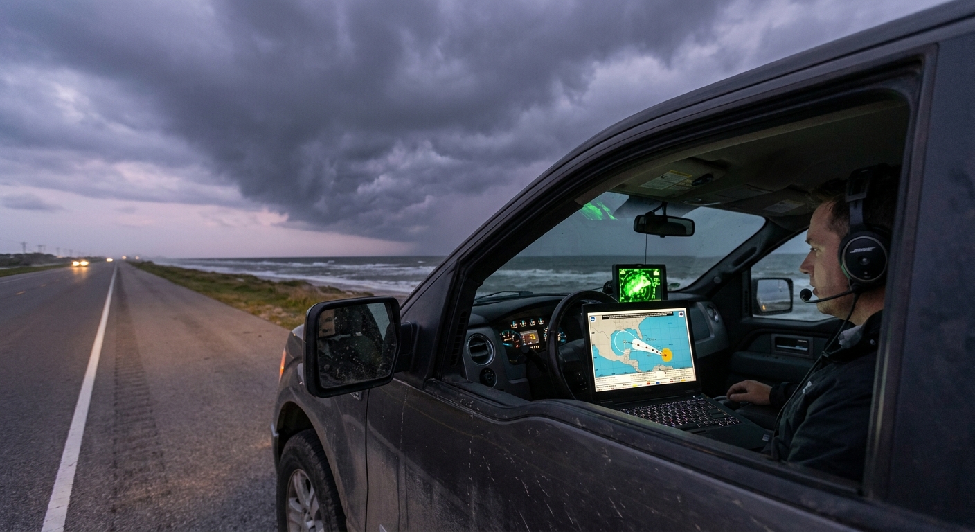
Radar and Recon: Pinpointing the Worst Strip of Coast
When landfall is imminent, we blend two precision tools:
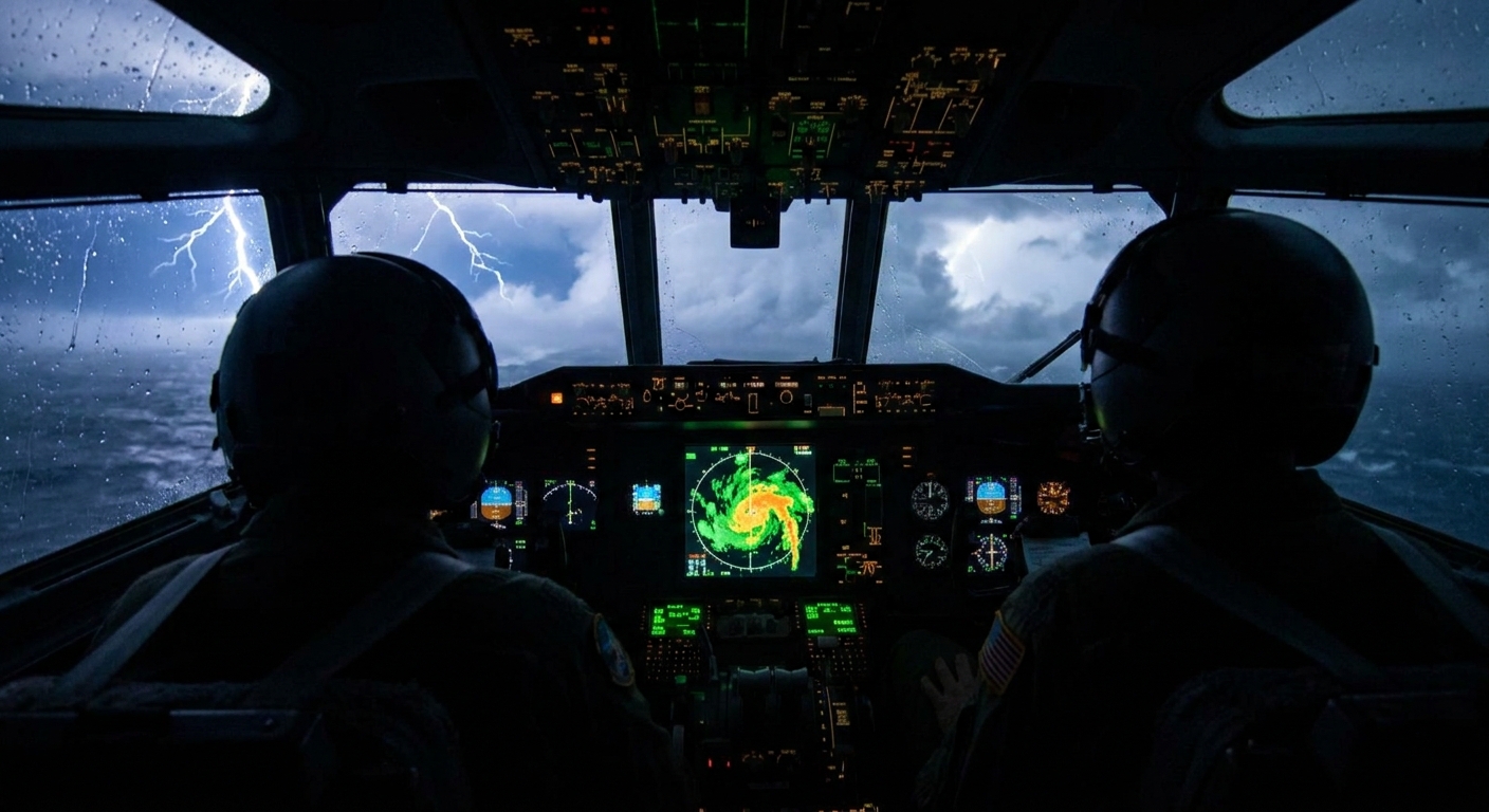
1. Aircraft Reconnaissance
- Vortex Data Messages pinpoint the center and max winds.
- Stepped-frequency microwave radiometers (SFMR) sample surface winds over the ocean.
- Fixes every few hours track the storm’s actual motion vs. model expectation.
A small heading change—10° to the left or right—can march the RFQ to a completely different section of coast.
2. Coastal Radar
- Reveals eyewall position and relative intensity (via reflectivity and velocity).
- Shows rainband orientation and where the heaviest bands are setting up.
- Helps estimate exact landfall point and timing.
On one Gulf intercept, we watched the radar core wobble east on several frames; recon confirmed a jog. In real time, we watched the RFQ’s target zone move 20–30 miles along the shoreline. Some evac zones went from bullseye to periphery in under two hours. Others saw their risk skyrocket.
We adjusted; some locals didn’t have time to.
Safety Protocols by Quadrant: How to Plan Like a Chaser
Even if you never plan to chase, thinking in quadrants can sharpen your survival strategy.
If You’re in the Potential Right-Front Zone
- Treat evacuation orders with maximum seriousness, especially in surge-prone areas.
- Plan to leave earlier than your neighbors; roads in RFQ corridors can become impassable fast.
- Build for flying debris and glass failure; interior rooms become your last refuge.
If You’re in the Left-Front Zone
- Still expect damaging winds and possible surge depending on local geography.
- Prepare for significant power outages and tree damage.
- Don’t underestimate the storm just because “the right side is worse.”
Inland Right-Rear and Left-Rear Zones
- Focus on flooding and tornadoes rather than pure wind.
- Track river and creek forecasts; flooding often peaks after the center has passed.
- Avoid travel during training band events; the road you drove in on may not exist a few hours later.
Case Study: A Tale of Two Towns
I once chased a landfalling Category 4 where two towns, only 30 miles apart, had completely different experiences.
- Town A ended up in the core RFQ. Surge smashed through ground floors; wind shredded roofs; the sound of breaking structures blended into one long, horrifying roar.
- Town B, just inside the LFQ, saw strong but survivable winds, sporadic structural damage, and far less surge.
Both had been inside the forecast cone for days. Both had time to prepare. But only one understood that the side of the storm could matter as much as the category.
That difference shaped who stayed, who evacuated, and who came back to intact homes.
Beyond Categories: Impact-Based Tracking
The Saffir–Simpson category tells you wind speed at a point, not:
- How big the wind field is.
- How high the surge will be at your exact stretch of coast.
- Where the worst rainbands and tornadoes will track.
Storm chasers quietly do impact-based tracking:
- We ask, “Where is the right-front quadrant going to hit shoreline?” not just “What category is it?”
- We care about storm size, forward speed, angle of approach, and local coastal shape.
You can borrow that mindset:
- Identify which quadrant you’re likely to experience based on forecast motion.
- Layer on local factors: bays, inlets, elevation, urban drainage.
- Prepare for the dominant hazards of your quadrant, not just the headline number.
Turning Fascination into Readiness
Hurricane tracking can feel like a distant sport—until your town ends up on the RFQ side at landfall.
If you’re already drawn to maps, radar loops, and model runs, you’re halfway to having a chaser’s edge. Use that fascination to:
- Analyze which side of the storm you’re on, not just whether you’re “in the cone.”
- Understand that a 20–40 mile track shift can flip your risk profile completely.
- Respect the ocean, terrain, and rivers as much as the swirling colors on your screen.
When the next hurricane spins toward your coast, don’t just ask, “How strong is it?” Ask, “Which side am I on?”
That single question has saved more lives in my chaser log than any category rating ever has.