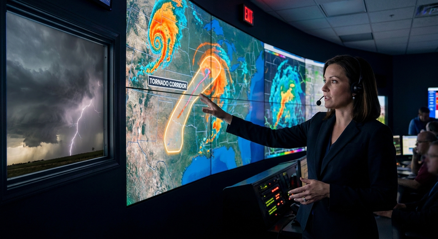
We talk a lot about drylines, outflow boundaries, and 500 mb troughs. But many chase days are already tilted toward success or failure months in advance by climate patterns—especially ENSO phases like El Niño and La Niña.
Why Climate Patterns Matter More Than You Think
For storm chasers, this isn’t just about where the best structure will be. These patterns control how storms evolve, what hazards dominate, and when things go bad after dark.
Let’s walk through how the big climate players stack the deck—and how you can chase them without becoming a statistic.
ENSO in the Driver’s Seat: El Niño vs. La Niña in the Field
El Niño: The Subtle Killer in the Trees
El Niño often strengthens the subtropical jet across the southern U.S., particularly in the cool season and early spring.
Field consequences:
- More southern-track systems: Texas, Louisiana, Mississippi, Alabama, Georgia, and Florida see enhanced storm activity.
- Frequent high-shear, low-CAPE environments: tornadoes with modest instability but screaming low-level winds.
- More nocturnal events: squall lines and QLCS systems racing through at midnight.
Chasing El Niño Setups
You may not get textbook, isolated LP supercells over a Kansas wheat field at 4 PM. Instead, you’ll fight:
- Trees and hills (Dixie Alley)
- Rain-wrapped circulations
- Fast storm motions (40–60+ kt)
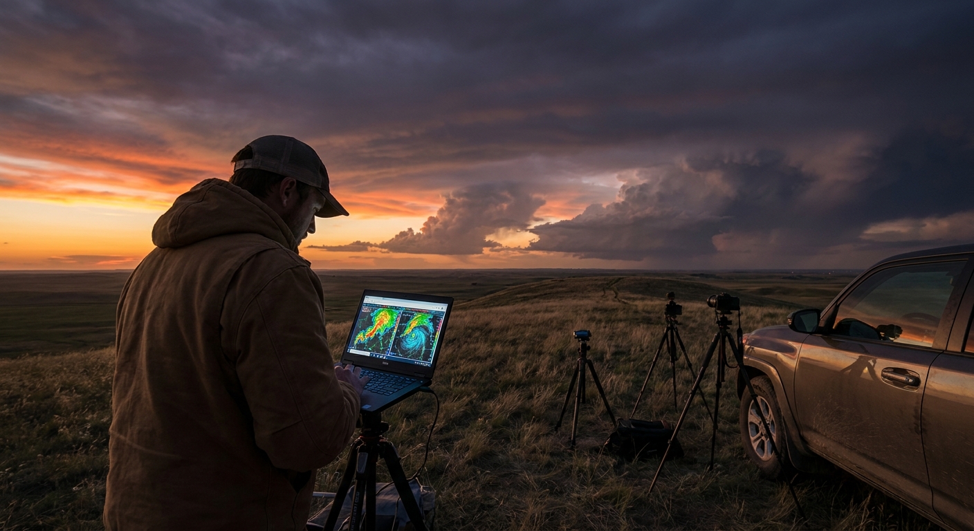
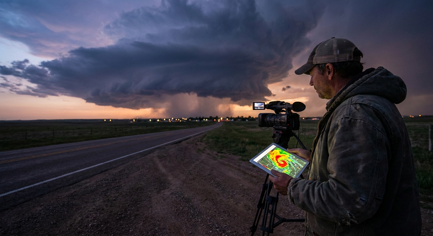
Radar becomes your lifeline. On these days you’re:
- Living in velocity products to find embedded mesovortices.
- Watching for tight couplets and fast-appearing TDS (tornado debris signatures) in QLCS lines.
- Using CC (Correlation Coefficient) to confirm debris in heavily rain-wrapped storms.
Safety shifts from staying out of the hook to never losing your orientation in the dark.
Key El Niño safety protocols:
- Hard boundaries on night chasing in trees. If your escape routes aren’t crystal-clear and paved, you stand down.
- Radar + GPS discipline. Two independent navigation sources; download offline maps.
- Zero heroics at landfalling tropical remnants. These can spawn messy tornado outbreaks with poor visibility and fast-moving cells.
La Niña: Plains Playgrounds and Overconfidence
La Niña shifts the favored storm track north and often supports more classic Plains chase setups in spring.
Field consequences:
- Frequent lee cyclogenesis in eastern Colorado/New Mexico.
- Strong southwest flow aloft over warm, moist Gulf return.
- Many dryline and warm front setups from Texas to South Dakota.
This is when a lot of chasers fall in love with the sky all over again:
- Elegant LP supercells with sculpted striations.
- Stacked-plate mesocyclones over open fields.
- Cyclic tornadic supercells tracking for hours.
But there’s a dark side: complacency.
La Niña Safety Traps
Storm spacing illusion
- Wide spacing lulls you into thinking you have unlimited maneuvering room. - Rapid storm mergers along boundaries can suddenly cut off escape routes.
Underrating flash floods
- Repeated rounds of slow-moving storms saturate soils. - The same mesocyclone that mesmerizes you can be dumping inches of rain downstream.
Tail-end Charlie tunnel vision
- Everyone piles onto the southern storm. - Traffic jams, impulsive U‑turns on two-lane roads, and blocked escape paths follow.
La Niña safety anchors:
- Plan 2–3 exit routes at all times—not just one.
- Assume water-covered roads are washed-out roads. Turn around.
- Don’t depend on cellular data for navigation when the towers go down.
Explainer: How Climate Patterns Change Storm Morphology
Climate doesn’t just change where storms form; it changes what types of storms dominate.
Jet Structure and Shear Profiles
El Niño and La Niña shift the jet stream. That reshapes hodographs:
- El Niño Dixie setups:
- Long, curved hodographs.
- Tremendous 0–1 km shear.
- Storms evolve quickly; discrete cells can merge into QLCS lines.
- La Niña Plains setups:
- Strong deep-layer shear but often more modest low-level shear early in the day.
- Cleaner storm modes with classic supercells along the dryline.
This directly impacts radar strategy:
- In El Niño years, you’re often tracking embedded mesovortices inside squall lines—small and fast, demanding high attention on velocity.
- In La Niña years, you’re frequently watching isolated mesocyclones evolve over time, analyzing occlusions, rear-flank downdrafts, and cycling behavior.
Moisture Quality and LCL Heights
Climate-driven storm track shifts affect Gulf moisture access:
- Richer moisture + backed surface winds (often La Niña + strong trough) = lower cloud bases, greater tornado potential.
- Marginal moisture + strong forcing (some El Niño cool-season events) = fast-moving storms that can still spin tornadoes with modest CAPE.
As a chaser, this is where meteorology meets survival.
A Night in Dixie: When Climate Patterns Narrow Your Options
One early spring El Niño night in Mississippi, the subtropical jet was screaming overhead. SPC had painted a broad moderate risk. The warm sector was juicy, but the surface low was ragged. On radar, a QLCS erupted, bowing segments with embedded circulations.
Roads were narrow, tree-lined, shoulders almost nonexistent.
Radar showed:
- Tight velocity couplets forming and dissipating in minutes.
- Brief TDS signatures—a likely wedge—that appeared and vanished in under 30 seconds of scan time.
We held to a strict protocol:
- No pushing east of pre-decided stop lines.
- No core punching. A rain-wrapped EF‑anything under those conditions is suicide.
- Constant escape vector awareness back to the west and southwest.
We never saw a fully illuminated tornado. But we watched the signatures rip across the radar, verified damage at first light, and drove away alive.
That entire night was born months earlier, when Pacific SST anomalies locked in an El Niño pattern.
How-To: Build Climate Patterns Into Your Chase Planning
Step 1: Macro Awareness (Months Out)
- Follow ENSO updates (NOAA CPC, BoM, ECMWF).
- Note: El Niño? Expect more southern cool-season and early spring action.
- Note: La Niña? Budget more time for classic Plains late-spring chasing.
Step 2: Regional Bias (Weeks Out)
- Use seasonal outlooks to identify favored storm tracks.
- If the guidance screams southern storm track, scout Dixie terrain and safe staging areas.
- If it screams High Plains, research target towns with good road grids and services.
Step 3: Daily Execution (Hours Out)
- Treat climate as background; mesoscale rules the day.
- Let:
- Morning soundings
- Surface analysis
- Satellite and radar
override any climate-based expectations.
- Adjust safety protocols:
- Dixie + El Niño + high shear = extreme caution after dark.
- Plains + La Niña + discrete supercells = extra vigilance for flooding and road congestion.
Conclusion: Respect the Patterns, Respect the Risks
Climate patterns like El Niño and La Niña don’t decide exactly where a tornado will touch down. But they decide which regions get the most shots, which modes dominate, and which safety traps await you.
If you chase with blinders on—focused only on the next RADAR frame—you miss the bigger story the planet is telling months in advance.
Learn that story. Read ENSO. Watch the jet. Then chase with fascination, not recklessness, in the narrow window between what the climate sets up and what the atmosphere unleashes.